GapMaps Live Australia
A GIS solution, made easy
GapMaps Live isn’t a regular GIS platform; we’re quicker, easier and powered with the most comprehensive location intelligence in Australia. Visualise your network on a cloud-based map and make the best location-based decisions. No expensive GIS certification, time-consuming GIS training or GIS engineer required.
No GIS experience required
Typically a Geographical Information System (GIS) is a complex software used for making location-based decisions. It hosts spatial information that is manipulated to analyse, visualise and map. Minimal changes and preloading the necessary data can be time-consuming and difficult.
GapMaps Live supplies the same intelligence in an easy to use, plug-in-and-play system. We have an in-house data and location intelligence advisory.
GapMaps Live is preloaded with specific industry data, POI and can be used easily to make faster, surer and more confident location decisions.
Faster
Simple to use, GapMaps Live speeds up all the elements of location-based decision-making. We provide easy-to-access location analytics – quickly.
Smarter
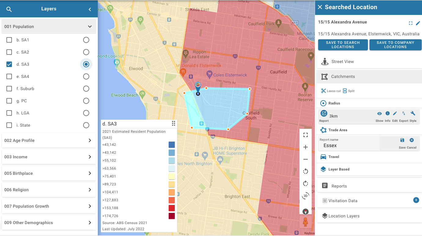
Draw catchments based on radius, drive time or create free-form areas. Create sales and franchise territories. Select the catchment and export location analytics reports with all the necessary demographics and location intel.
Surer
We are powered by regularly updated data sets and in-house location intelligence experts. So your team can make faster, smarter and more confident decisions.
Better location-based decisions
"Without GapMaps we could do due diligence on three future sites a week. Now we can do fifty. And we can look at sites from Cairns to Adelaide and make decisions in hours.
– David Brown – Retail Fuel Developments
Contact us to learn more
What is GapMaps Live’s GIS solution?
GapMaps Live is a GIS solution accessed via a cloud-based mapping platform. View the fastest and most comprehensive location intel available integrated with your business’s data.
GapMaps Live represents the next generation of GIS location platforms.
Our GapMaps Live platform was built to solve our founders’ own location decision problems. Technology is built by the people who need it. Our GIS solution is an easy-to-navigate and robust platform powered by regularly updated data sets and in-house location intelligence experts. Our data team curates, checks and updates data sets via multiple sources. We then translate the data into an easy-to-digest and understandable format. We enable your team to answer critical location questions quickly and with ease.
Deep sector expertise
Our treasure trove of data and insights provides market and catchment metrics that are unique to the GapMaps Live platform.
GapMaps GIS solution has a deep understanding of core sectors, including:
- Childcare / Long Day Care
- Cafe
- Fast Food and QSR ( Quick Service Restaurants).
- Health & Fitness
- Retail
- Commercial Property Development
- Residential Aged Care
- Auto Tyres & Servicing
- Fuel
- Medical Services
What are GapMaps Live features?
- Make it yours – add your data to refine market planning opportunities.
- See it your way- Style your own catchments – via radius, drive time, walk time or freeform.
- Go macro or go micro – Scale your sales & Territories to suit your business. Detailed or top-level reports on catchments.
- Go with the flow- Understand human & traffic movement patterns across your network.
- Remove the guesswork – Discover industry-leading, supply-and-demand insights.
- Know your surroundings – Understand your competitive landscape with access to points of interest data.
What integrated live datasets does GapMaps Live offer?
- Demographic information, including the 2021 ABS Census
- Population forecasts
- Household expenditure insights
- Over 50 categories of Points of Interest (POI) data
- Development approvals data
- Traffic data integration
- Sector-specific supply and demand data


