GapMaps Connect
With GapMaps Connect, you can capture location intel on the move updated in GapMaps Live in real-time.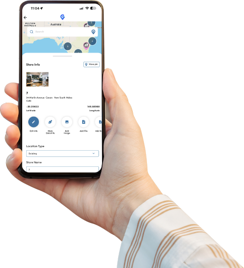
About GapMaps Connect
GapMaps Connect is a free mobile app available to GapMaps Live users on the Apple App Store and Google Play Store. GapMaps Connect allows you to record asset intel, collect field data, notes, photos, files and additional data for any existing location or proposed location. Simply login to the app using your existing GapMaps Live credentials and all on site intel you collect will be recorded and updated immediately in GapMaps Live.
Transcript
That’s where GapMaps Connect comes in. GapMaps Connect is a mobile app that allows GapMaps Live users to record notes, photos, files and additional data for any existing store or proposed location – updated in GapMaps Live in real-time. These insights can then be used to manage and maintain store assets, collect field data, validate store attributes, site scoring and much more.
Get an accurate view of the assets being used across all your locations and record important details such as make/model, serial number, year purchased and photos so you can maintain a complete asset register in GapMaps Live and identify when maintenance may be required.
You can also use intel collected from GapMaps Connect to gain a better understanding of each store’s existing site attributes and enhancements needed to improve performance. For example, a fast-food restaurant could capture how many self-service registers exist in each store, the number of car parks or if a drive thru exists in GapMaps Connect with this information easily accessible in GapMaps Live.
And if you find a potential new location you’re interested in whilst on the move, you can easily capture details of that location to help you make better investment decisions.
With GapMaps Connect you’ll have all the facts in one place with GapMaps Live and remove the guesswork from location decisions.

Manage and maintain your assets
Keep track of what equipment is being used across all your locations such as age, make/model and serial numbers so you can easily identify when upgrades or maintenance scheduling is required.
Real-time dataset updates
You can collect field data such as site attributes, notes, images and access files across your entire network or proposed locations in minutes – updated in GapMaps Live in real-time.
Plan store refurbishments
Use photos and input data captured in GapMaps Connect to help make decisions on what internal and external enhancements are needed to improve store performance by gaining a better understanding of each store’s existing attributes. Are there enough self-service registers? Is the seating layout sufficient? Is the menu board signage easily visible? Are more drive-thru lanes needed?
Get the latest facts on new locations
Collect all the details you need to assess new site opportunities whilst you’re on the move – take photos and notes then upload straight into GapMaps live for later assessment.